
Last updated October 2026
Tauranga South is a well-established central suburb of Tauranga, sitting just south-west of the city centre and close to the harbour edge. It forms part of the Te Papa neighbourhood and ward, offering convenient access to the CBD, major schools, Tauranga Hospital and everyday shopping.
Residential streets mix with key community facilities along corridors such as Cameron Road and Fraser Street. The area suits visitors exploring the city core and people considering a central base with strong local amenities. Its position between the Waikareao and Waimapu estuaries places it within easy reach of both urban services and nearby harbour views.
Official Suburb Facts
- Population (2023 Census)
- About 5,790, up 5% since 2018
- Land area
- 3.03 km²
- Location
- 2.2 km south of central Tauranga
- Council
- Tauranga City Council
- Ward or local board
- Te Papa General Ward
- Getting there
- Main access via Cameron Road and Fraser Street; multiple Baybus routes serve stops along Cameron Road connecting to the city centre, Greerton, Welcome Bay and other suburbs
- Main shopping
- Fraser Cove shopping centre
- Schools
- Tauranga Intermediate, Tauranga Boys’ College, St Mary’s Catholic School, Tauranga Special School
- Nearby landmarks
- Tauranga Hospital, The Historic Village on 17th Avenue, Gate Pā memorial area, Tauranga city centre
Who Lives in Tauranga South
About 5,790 residents in 2,270 households. From the 2023 Census, with the New Zealand figure alongside for comparison.
In Tauranga South
Places and businesses inside the official Tauranga South boundary.
Places
Businesses


About Tauranga South
Tauranga South lies immediately south-west of Tauranga Central, north-east of Gate Pā and near the Waikareao Estuary to the north-west and Waimapu Estuary to the south-east. It sits within the broader Te Papa Peninsula area that includes the CBD, Sulphur Point, Fraser Cove, Gate Pā, Merivale and parts of Greerton.
The suburb is a practical residential and service hub rather than a tourist destination in its own right, yet its central location makes it a useful base for exploring Tauranga.
The area developed as Tauranga expanded beyond the original Te Papa mission and settlement lands. Today it combines established housing with significant community infrastructure.
Fraser Cove shopping centre anchors local retail, while major education providers and the regional hospital draw people from across the city. Cameron Road serves as the primary north-south spine, carrying traffic, buses and ongoing corridor improvements for walking, cycling and public transport.
Culturally the wider Te Papa and Gate Pā area holds deep significance for Tauranga Moana iwi, particularly Ngāi Te Rangi, Ngāti Ranginui and associated hapū. The nearby Battle of Gate Pā (Pukehinahina) in 1864 remains a defining event in local and national history.
While Tauranga South itself is primarily a modern residential suburb, its proximity to these sites and to the historic Te Papa peninsula connects it to the longer story of the harbour and its people.
Visitors and residents experience a functional, accessible neighbourhood with good everyday facilities. The mix of schools, medical services, retail and proximity to the CBD supports both short stays and longer-term living. Quiet residential pockets sit alongside busier commercial strips, giving the suburb a balanced urban character.
Getting Around
Cameron Road is the main arterial route running through Tauranga South, linking the city centre southward toward Greerton and beyond. Fraser Street provides an important parallel corridor and access to Fraser Cove.
Baybus services operate frequently along Cameron Road, with stops serving routes that connect to the Durham Street city terminal, Greerton, Welcome Bay, Bethlehem and other parts of Tauranga. Ongoing upgrades along the Cameron Road corridor aim to improve capacity, safety and options for buses, cycling and walking.
The suburb’s central position means most destinations within Tauranga are a short drive or bus ride away. Parking is available at Fraser Cove and around the hospital and schools, though peak times can be busy. The flat to gently rolling terrain suits cycling and walking for local trips.
Shopping and Dining
Fraser Cove is the primary shopping destination in Tauranga South. The centre includes a supermarket, The Warehouse and a range of specialty stores and services in a large-format retail setting with extensive parking. It meets everyday needs for groceries, household goods and convenience shopping.
Smaller local businesses and services are found along Cameron Road and nearby streets. For a wider choice of cafés, restaurants and specialty retail, the Tauranga city centre is only a short distance north.
History and Heritage
The land around Tauranga South forms part of the traditional rohe of Tauranga Moana iwi. European settlement expanded from the Te Papa mission station, and the suburb grew as the town developed southward in the twentieth century.
Nearby Gate Pā (Pukehinahina) was the site of a major engagement in the New Zealand Wars on 29 April 1864, when Māori forces successfully defended the pā against a much larger British force. Memorials and the Gate Pā reserve commemorate the battle and its participants.
Within Tauranga South itself, The Historic Village on 17th Avenue preserves and displays buildings and stories from the region’s past. Schools such as Tauranga Boys’ College (with roots in the mid-1940s) and Tauranga Intermediate (opened 1958) reflect the post-war growth of the city. Tauranga Hospital remains a key regional facility located in the suburb.
Near Tauranga South
Just outside Tauranga South, within 5 km of its centre, nearest first.
Places
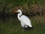 The White Heron in
 Spotting the Shining Cuckoo inWaikareao Estuary WalkwayGate Pā Historic ReserveBrain-Watkins House Museum
Businesses






Where to Learn More
Tauranga City Council Neighbourhoods: Official overview of Te Papa neighbourhood boundaries and community projects.
Tauranga South Wikipedia: Summary of location, facilities, schools and demographics with cited sources.
NZ History – Gate Pā: Authoritative account of the 1864 battle and its significance to Tauranga Moana.
Frequently Asked Questions
Where is Tauranga South located?
Tauranga South is a central suburb of Tauranga, immediately south-west of the city centre, north-east of Gate Pā, and within the Te Papa ward.
What ward is Tauranga South in?
It sits in the Te Papa General Ward, which also covers the CBD, Sulphur Point, Fraser Cove, Gate Pā, Merivale and northern Greerton.
What is the main shopping centre in Tauranga South?
Fraser Cove shopping centre is the main retail hub, with a supermarket, The Warehouse and other stores plus large car parking.
Which schools are in Tauranga South?
Key schools include Tauranga Intermediate, Tauranga Boys’ College, St Mary’s Catholic School and Tauranga Special School.
Is Tauranga Hospital in Tauranga South?
Yes, Tauranga Hospital is located in the suburb and serves as a major regional public hospital.
How do I get to Tauranga South by bus?
Baybus routes run along Cameron Road with stops serving the suburb and connecting to the city centre and other parts of Tauranga.
What is nearby for visitors interested in history?
The Historic Village on 17th Avenue is in the area, and the Gate Pā memorial reserve commemorating the 1864 battle is close by.
Is Tauranga South a good base for exploring the city?
Yes, its central location near the CBD, hospital, schools and main roads makes it convenient for both short visits and longer stays.
Spotted something incorrect on this page? Let us know.
Explore Tauranga only lists suburbs officially recognised by Land Information New Zealand (LINZ), and Tauranga South is one of them. Suburb boundary: LINZ, CC BY 4.0.