
Last updated October 2026
Judea is a western Tauranga suburb on State Highway 2, just east of Bethlehem and close to the Waikareao Estuary. Also known as Huria, it sits within the Bethlehem neighbourhood and ward, offering a mix of residential streets, industrial pockets and strong Māori cultural presence through Huria Marae.
The area grew from a 1860s military redoubt into a settled community linked to Ngāi Tamarawaho of Ngāti Ranginui. Visitors and residents find it convenient for access to central Tauranga while retaining a quieter local character. Green spaces and estuary edges add outdoor options nearby.
Official Suburb Facts
- Population (2023 Census)
- About 3,490, up 2% since 2018
- Land area
- 1.89 km²
- Location
- 2.4 km south-west of central Tauranga
- Council
- Tauranga City Council
- Neighbouring suburbs
- Brookfield, Tauranga South, Bethlehem, Tauranga, Gate Pa
- Ward or local board
- Bethlehem General Ward (Bethlehem neighbourhood)
- Main shopping
- Bethlehem Town Shopping Centre (nearby in the Bethlehem neighbourhood); local convenience options along main routes.
- Nearby landmarks
- Huria Marae, Waikareao Estuary, Judea Reserve, Carmichael Reserve (Bethlehem area).
Who Lives in Judea
About 3,490 residents in 1,330 households. From the 2023 Census, with the New Zealand figure alongside for comparison.
Schools in Judea
There is no school inside the Judea boundary, but these schools have enrolment zones that cover some or all of it.
Zoned for Judea
Show all 8 zoned schools
Zones change, so confirm with the school before relying on one.
Bin Day in Judea
by 7am on collection day
Streets near a suburb edge can differ, so check the council lookup if unsure.
Streets in Judea
54 streets are in Judea. Search any street in Tauranga to see which suburb it is in.
Show all 54 streets in Judea
- A
- Abbey Way
- Amber Crescent
- B
- Barberry Street
- Bell Street
- Bethel Way
- Birch Avenue
- Birmingham Street
- Blenheim Place
- C
- Cambridge Road
- Chester Street
- Churchill Road
- Collingwood Street
- Coventry Street
- Cypress Street
- D
- David Street
- Dell Way
- E
- Erica Street
- F
- Fergusson Way
- G
- Glambourne Way
- H
- Himalayan Close
- J
- Judea Road
- K
- Kelvin Way
- Koromiko Street
- L
- Lebanon Street
- Linley Terrace
- London Place
- M
- Manchester Way
- Matiu Crescent
- McCord Avenue
- Michael Way
- Miden Court
- Montgomery Road
- N
- Nicolas Place
- O
- Oak Lane
- Otumoetai Road
- P
- Paine Street
- Palm Grove
- R
- Rahipere Court
- Redmond Street
- Robins Road
- S
- Samuel Way
- State Highway 2
- T
- Taiahiahi Lane
- Takitimu Drive
- Tamatea Arikinui Drive
- Te Atatu Place
- Te Reti Views
- Te Waahi Haiona
- Tekoah Place
- V
- Verona Way
- W
- Waihi Road
- Wayne Place
- Winwood Way
- Z
- Zion Way
A long road is listed in each suburb it runs through.
Safety and Hazards
Higher than the Tauranga average for the number of people who live here. Busy beaches, town centres and nightlife draw lots of visitors, which lifts the figure. Another 52 reports were at shops and businesses.
Buses from Judea
11 bus stops inside the suburb.
Typical weekday daytime frequency.
Weather and Rent at a Glance
Weather is city-wide; rent is for this suburb.
In Judea
Places and businesses inside the official Judea boundary.
Places
Businesses
See all businesses in Judea

About Judea
Judea (Huria) occupies a position on the western side of Tauranga, between Bethlehem to the west and areas toward Gate Pā and Tauranga South.
Judea (Huria) occupies a position on the western side of Tauranga, between Bethlehem to the west and areas toward Gate Pā and Tauranga South. It lies near the Waikareao Estuary, which shapes the local landscape and provides a natural edge.
The suburb forms part of the broader Bethlehem neighbourhood under Tauranga City Council, which also takes in subdivisions around Bethlehem and proposed growth areas further west.
The name Huria is the Māori name associated with the place and its marae. Huria Marae on Te Kaponga Street is the tribal meeting place of the Ngāti Ranginui hapū of Ngāi Tamarawaho. The whare tipuna is Tamatea Pokaiwhenua, with wharekai including Ihuparapara. The marae connects to Takitimu waka, maunga Mauao, and awa including Kopurererua and Waikareao.
European settlement of the area as a fortified position began in 1864 during the New Zealand Wars. India Redoubt (later known as Judea Redoubt or Huria Redoubt) was one of three fortified European forts established in the Tauranga district as part of operations against local Māori. The redoubt period left a historical footprint that sits alongside the enduring Māori presence at Huria.
Today Judea is a residential suburb with a practical mix of housing, some industrial activity, and community facilities. It is often grouped with neighbouring Brookfield in council community updates.
Residents value proximity to the city centre, relative quiet, and access to estuary and reserve spaces. The suburb sits within easy reach of larger amenities in Bethlehem and central Tauranga while keeping a distinct local identity centred on the marae and surrounding streets.
History and Heritage
The 1864 establishment of the redoubt marked a key moment in the Tauranga campaign of the New Zealand Wars.
The 1864 establishment of the redoubt marked a key moment in the Tauranga campaign of the New Zealand Wars. Soldiers present at related actions, including the siege of Maketū and battles at Pukehinahina and Te Ranga, recorded the Judea redoubt in contemporary sketches and watercolours now held in local collections. The site later transitioned from military use into civilian settlement.
Alongside this colonial history sits the continuous occupation and cultural life of Ngāi Tamarawaho. Huria Marae remains the focal point for hapū gatherings, education and community activity.
Council records and Māori Maps confirm its role as a living marae for the hapū of Ngāti Ranginui. Heritage material held by Tauranga City Libraries (Pae Korokī) includes artworks and references to the redoubt period.
Getting Around and Local Character
State Highway 2 provides the primary road link through and past Judea, connecting Bethlehem with central Tauranga and beyond.
State Highway 2 provides the primary road link through and past Judea, connecting Bethlehem with central Tauranga and beyond. Local streets such as Judea Road serve residential and light industrial pockets. Bay Hopper bus services operated under Bay of Plenty Regional Council cover western Tauranga routes; stops and timetables are available via the regional council and Bee Card system.
The suburb’s character is practical and community-oriented. It sits close enough to Bethlehem Town Shopping Centre for everyday retail and services, while the Waikareao Estuary edge and nearby reserves offer walking and green space.
Judea Reserve appears in council maintenance schedules, indicating active open-space management. The area is frequently paired with Brookfield in Tauranga City Council Vital Update community profiles, reflecting shared neighbourhood identity.
Near Judea
Just outside Judea, within 5 km of its centre, nearest first.
Places
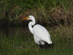 The White Heron in Tauranga
 Spotting the Shining Cuckoo in TaurangaTauranga Historic VillageKōpūrererua Valley Reserve
Show 2 more places
Businesses
Explore all Tauranga businesses



Where to Learn More
Wikipedia: Judea, New Zealand: Overview of location, history of the redoubt, demographics context and marae details with citations.
Māori Maps: Huria (Judea): Authoritative marae information including hapū, iwi, whare names, ancestral connections and address.
Tauranga City Council: Neighbourhoods: Official neighbourhood and ward boundaries confirming Judea within the Bethlehem neighbourhood.
Frequently Asked Questions
What is the population of Judea?
About 3,490 people lived in Judea at the 2023 Census, up 2% since 2018. See Who Lives in Judea
Which schools are zoned for Judea?
Te Kura o Manunui's zone covers all of Judea. Bethlehem School, Tauranga Primary School, Tauranga Intermediate, Ōtūmoetai Intermediate and 3 more have zones covering part of it. Zones change, so check an address with the school. See Schools in Judea
What day is rubbish collected in Judea?
Wednesday. Bins go out by 7am on collection day. Streets near the edge of the suburb can differ, so check the council lookup if unsure. See Bin Day in Judea
What buses run from Judea?
Route 60, about every 20 min; routes 7 and 62, about every 30 min. There are 11 stops in the suburb. See Buses from Judea
Is Judea in a tsunami or flood zone?
About 12% of Judea is inside the tsunami evacuation zone, and about 20% of its land is in the council's mapped flood areas. A long or strong earthquake means move to high ground or inland straight away. Check a street on the council flood map before you buy. See Safety and Hazards
Where can I take my dog in Judea?
Waikareao Estuary Walkway: dogs allowed. See every dog park and walk in Tauranga.
What is the Māori name for Judea?
Huria. The local marae is known as Huria Marae.
Which ward is Judea in?
Bethlehem General Ward. It forms part of the Bethlehem neighbourhood under Tauranga City Council.
What marae is in Judea?
Huria Marae (also listed with a Brookfield address on some maps) is the meeting place of Ngāi Tamarawaho of Ngāti Ranginui. The whare tipuna is Tamatea Pokaiwhenua.
Spotted something incorrect on this page? Let us know.
Explore Tauranga only lists suburbs officially recognised by Land Information New Zealand (LINZ), and Judea is one of them. Suburb boundary: LINZ, CC BY 4.0.
Sources and data notes 8
- Official Suburb Facts: Boundary, area and neighbours: LINZ, CC BY 4.0. Population: Stats NZ 2023 Census usually resident population, CC BY 4.0, summed from the statistical areas inside the boundary.
- Who Lives in Judea: Stats NZ 2023 Census, CC BY 4.0. Figures are summed from the census areas inside the official Judea boundary. Percentages are of the people or homes that answered each question; a figure is left out when fewer than 100 answered.
- Schools in Judea: Ministry of Education school directory and enrolment zones (CC BY 4.0 and CC BY 3.0 NZ), October 2026.
- Bin Day in Judea: Tauranga City Council collection areas.
- Streets in Judea: LINZ NZ Addresses road data, CC BY 4.0.
- Safety and Hazards: NZ Police victimisation data, CC BY 4.0, September 2025 to August 2026 (crimes inside homes are only published for burglary); Bay of Plenty Regional Council tsunami evacuation zone (October 2025); Tauranga City Council flood risk map (depth 300 mm or more) and Western Bay of Plenty District Plan flood hazard areas.
- Buses from Judea: Bay of Plenty Regional Council Baybus timetable data, CC BY 4.0.
- Weather and Rent at a Glance: NIWA climate averages 1991-2020 (via Figure.NZ); Tenancy Services rental bond data (new bonds in the suburb’s Stats NZ areas), July 2025 to June 2026, CC BY 3.0 NZ.