
Last updated October 2026
Brookfield is a residential suburb on the western side of Tauranga, set between Bethlehem, Ōtūmoetai, Bellevue and Judea beside the Waikareao Estuary. It offers a mix of established housing, a local commercial centre and green spaces that serve everyday needs for residents and visitors exploring western Tauranga.
The suburb sits within easy reach of the city centre while retaining a neighbourhood feel. Huria Marae anchors the area’s strong Ngāti Ranginui connections, and community facilities continue to evolve around parks and the local school.
Official Suburb Facts
- Population (2023 Census)
- About 5,880, up 5% since 2018
- Land area
- 2.17 km²
- Location
- 2.4 km west of central Tauranga
- Council
- Tauranga City Council
- Ward or local board
- Matua-Otūmoetai General Ward (parts also linked to Bethlehem General Ward)
- Getting there
- Main access via Otūmoetai Road, Millers Road and Bellevue Road; regular bus services connect the Brookfield commercial centre to the wider Tauranga network
- Main shopping
- Brookfield commercial centre (local shops and supermarket)
- Schools
- Te Kura o Manunui (Years 1–6 state primary, formerly Brookfield School; offers full-immersion Māori and bilingual classes)
- Nearby landmarks
- Huria Marae, Sydenham Botanic Park, Lees Park, Waikareao Estuary
Who Lives in Brookfield
About 5,880 residents in 2,070 households. From the 2023 Census, with the New Zealand figure alongside for comparison.
About Brookfield
Brookfield forms part of Tauranga’s western suburbs, lying inland from the harbour edge and close to the Waikareao Estuary. The suburb is largely residential, with a practical commercial centre that supports daily shopping and services. Its position between Bethlehem to the west and Ōtūmoetai and Bellevue to the north places it within a short drive or bus ride of the central city and harbour amenities.
The area has longstanding ties to Ngāti Ranginui. Huria Marae (also known in association with Judea) is located in Brookfield and is the marae of Ngāi Tamarāwaho hapū. The whare tipuna is named Tamatea Pōkaiwhenua. The marae connects to the maunga Mauao and the awa Kopurererua and Waikareao, reflecting the wider Tauranga Moana cultural landscape.
Today Brookfield functions as an established neighbourhood with a mix of family homes and community facilities. Council planning documents identify the Brookfield commercial centre as a suburban hub, with ongoing attention to bus facilities, walking and cycling links, and open-space improvements.
Local parks such as Lees Park and Sydenham Botanic Park provide green space for play and recreation, and the primary school has been rebuilt and renamed to better serve the community.
Visitors and prospective residents will find a practical base for exploring western Tauranga. The suburb’s proximity to the estuary and neighbouring areas makes it convenient for harbour walks, while the local centre covers everyday needs without requiring a trip into the city centre for basic shopping.
History and Heritage
Brookfield sits within the traditional rohe of Ngāti Ranginui. Huria Marae remains a living centre for Ngāi Tamarāwaho, with ancestral links to the Takitimu waka, Mauao, and the waterways of the harbour. The marae complex includes the whare tipuna Tamatea Pōkaiwhenua and associated wharekai.
European settlement and later suburban development shaped the residential character seen today. The suburb’s name and street layout reflect mid-twentieth-century expansion of Tauranga’s western fringe. More recent community investment has focused on the school rebuild and park upgrades, continuing the pattern of local facilities serving a growing residential population.
Getting Around and Local Amenities
Otūmoetai Road, Millers Road and Bellevue Road form the main road network through Brookfield. The commercial centre is clustered near key intersections and is served by bus routes that link to the wider Tauranga public transport network. Council spatial planning has highlighted improvements to bus stops, pedestrian safety and cycle connections around the centre and school.
For outdoor time, Lees Park and Sydenham Botanic Park are the standout local green spaces. Sydenham Botanic Park is a larger site with potential for enhanced community use and play facilities; Lees Park has long provided neighbourhood open space.
The nearby Waikareao Estuary offers further opportunities for walking and nature observation on the harbour edge. These spots suit short local outings rather than destination day trips.
Near Brookfield
Just outside Brookfield, within 5 km of its centre, nearest first.
Places
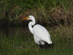 The White Heron in
 Spotting the Shining Cuckoo inKōpūrererua Valley Reserve
Businesses






Where to Learn More
Wikipedia: Brookfield, New Zealand: Overview of the suburb, location, education and demographic context with cited sources.
Tauranga City Council: Ward boundaries: Official description of the Matua-Otūmoetai ward and other city wards.
Māori Maps: Huria (Judea) Marae: Details of the marae location, hapū, iwi and ancestral connections.
Frequently Asked Questions
Where is Brookfield in Tauranga?
Brookfield is a western suburb of Tauranga, lying between Bethlehem, Ōtūmoetai, Bellevue and Judea, near the Waikareao Estuary.
Which council ward covers Brookfield?
Brookfield is primarily within the Matua-Otūmoetai General Ward. Some references also note links to the Bethlehem General Ward.
What school is in Brookfield?
Te Kura o Manunui is the local state primary school for Years 1 to 6. It was previously known as Brookfield School, was rebuilt on a new site, and offers full-immersion Māori language and bilingual classes.
Is there a shopping centre in Brookfield?
Yes. The Brookfield commercial centre provides local shops and a supermarket for everyday needs and is recognised as a suburban hub.
What parks are in or near Brookfield?
Lees Park and Sydenham Botanic Park are key local open spaces. The Waikareao Estuary is also close by for harbour-edge walks.
What is Huria Marae?
Huria Marae is located in Brookfield and is the marae of Ngāi Tamarāwaho hapū of Ngāti Ranginui. The whare tipuna is Tamatea Pōkaiwhenua.
How do I get to Brookfield by public transport?
Bus services run to the Brookfield commercial centre and connect with the wider Tauranga network. Check current Baybus timetables for routes and times.
Is Brookfield a good base for exploring western Tauranga?
Yes. Its central position among western suburbs, local shops, parks and proximity to the estuary make it practical for both short stays and everyday living while remaining close to the city centre.
Spotted something incorrect on this page? Let us know.
Explore Tauranga only lists suburbs officially recognised by Land Information New Zealand (LINZ), and Brookfield is one of them. Suburb boundary: LINZ, CC BY 4.0.