
Last updated October 2026
Parkvale is a residential suburb in southern Tauranga, also widely known as Merivale. Locals and many organisations prefer Merivale, while maps, emergency services and some official references use Parkvale; both names are recognised.
The area carries the Māori name Tutarawanga or Tūtarawānanga, linked to a former pā site and early school. It sits near Gate Pā and Greerton, with the Waimapu Estuary close by, and is home to the significant arboretum at Tutarawānanga – Yatton Park.
The suburb developed after World War II from subdivided family farms and remains a close-knit community with its own primary school and local shops.
Official Suburb Facts
- Population (2023 Census)
- About 2,720, up 4% since 2018
- Land area
- 1.05 km²
- Location
- 3.9 km south-west of central Tauranga
- Council
- Tauranga City Council
- Neighbouring suburbs
- Gate Pa, Greerton, Tauranga South
- Ward or local board
- Te Papa General Ward
- Getting there
- Main access via Fraser Street and links to Cameron Road; urban bus services operate through the wider Te Papa and southern Tauranga network
- Main shopping
- Merivale shops
- Schools
- Merivale School (Te Kura o Tūtarawānanga), Years 1–6, Kesteven Avenue
- Nearby landmarks
- Tutarawānanga – Yatton Park, Merivale Community Centre, Waimapu Estuary, Gate Pā
Who Lives in Parkvale
About 2,720 residents in 870 households. From the 2023 Census, with the New Zealand figure alongside for comparison.
In Parkvale
Places and businesses inside the official Parkvale boundary.
Places
Businesses

About Parkvale
Parkvale occupies a pocket of southern Tauranga between Gate Pā and Greerton, with the Waimapu Estuary forming a natural edge. The land was originally known to tangata whenua as Tutarawānanga. It was the site of a pā and the first school in Tauranga Moana. Hapū with connections include Ngāi Te Ahi, Ngāti Ruahine, Ngāi Tamarāwaho and Ngāti Tapu.
After the battles of Gate Pā and Te Ranga, land in the locality was allocated to Māori who had not fought against Imperial troops. John Chadwick later acquired much of the surrounding land.
Trees planted around 1866 form the core of what is now a nationally notable arboretum at Yatton Park. The modern suburb took shape after World War II when six family farms, including the Merrivale Estate, were bought by developers and subdivided for housing.
Today the area is a compact residential neighbourhood with a strong community focus. Residents and local groups generally use the name Merivale, while some maps and dispatch systems list Parkvale.
Council materials often note both, and the dual naming of the park as Tutarawānanga – Yatton Park followed advocacy by tamariki from Merivale School. The suburb feels settled and local, with everyday facilities centred on the school, community centre and small shopping strip rather than large commercial hubs.
Visitor experience centres on the park’s mature trees, open spaces and cultural history, plus easy access to neighbouring Gate Pā and Greerton amenities. The estuary edge offers a sense of the harbour landscape that once defined the wider area.
History and Heritage
The name Tutarawānanga reflects the site’s long Māori occupation. A pā stood here, and the first school in Tauranga Moana was established on the land.
Post-1864 land allocations and subsequent European purchase by the Chadwick family shaped early European farming. Homesteads overlooked the Waimapu, and plantings from the 1860s created the tall exotic and native specimens that still define Yatton Park.
In the mid-twentieth century the Douglas family held the core park land before it was acquired for public use. Council later cleared overgrowth, formed a loop road and added ornamental water features.
The dual name Tutarawānanga – Yatton Park was formally adopted after research and a presentation by Merivale School students, restoring recognition of the site’s cultural significance alongside its European park history.
Suburban streets and state housing filled out the former farms from the 1950s onward. Merivale School opened in 1957 and continues as a central community anchor, offering bilingual and rumaki pathways.
Getting Outdoors
The standout green space is Tutarawānanga – Yatton Park, an arboretum of tall exotic and native trees planted in the same era and competing for height. Many rank among the tallest of their species in the country.
The park is partially vehicle-accessible, with opening hours that extend in daylight-saving months. It is popular for walks, picnics and wedding ceremonies. The nearby Waimapu Estuary provides a tidal edge and harbour outlook. Smaller local reserves and the community garden support everyday outdoor use without large formal sports complexes inside the suburb itself.
Community Facilities
Merivale School (Te Kura o Tūtarawānanga) on Kesteven Avenue serves Years 1–6 and hosts early childhood and kōhanga reo facilities on or beside the site. The Merivale Community Centre sits nearby and works closely with the school and whānau. Local shops meet day-to-day needs.
Council has noted new or improved community centre provision serving Merivale and Gate Pā as part of wider Te Papa neighbourhood investment. Fraser Street is a key local corridor; traffic and speed have been raised as community concerns for pedestrians and school travel.
Near Parkvale
Just outside Parkvale, within 5 km of its centre, nearest first.
Places
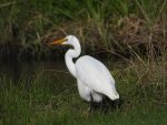 The White Heron in
 Spotting the Shining Cuckoo inWaimapu Estuary WalkwayTauranga Historic Village
Businesses





Where to Learn More
Tauranga City Council – Tutarawānanga Yatton Park: Official park information, cultural background, opening hours and history PDF.
Wikipedia – Merivale, Tauranga: Overview of the dual naming, post-war development and education notes with cited sources.
Tauranga City Council – Ward boundaries: Confirms Te Papa ward coverage including Merivale and Yatton Park.
Frequently Asked Questions
Is Parkvale the same as Merivale?
Yes. Parkvale and Merivale refer to the same Tauranga suburb. Locals and many organisations use Merivale; some maps and emergency services use Parkvale. Both names are officially recognised.
What is the Māori name for the area?
The area is known as Tutarawanga or Tūtarawānanga. The main park carries the dual name Tutarawānanga – Yatton Park.
Which council ward is Parkvale in?
Parkvale (Merivale) lies in the Te Papa General Ward of Tauranga City Council.
What school is in Parkvale?
Merivale School (Te Kura o Tūtarawānanga) is a co-educational state primary school for Years 1–6 on Kesteven Avenue.
Where are the main shops?
Day-to-day shopping is at the Merivale shops, south of which sits Yatton Park.
What is special about Yatton Park?
Tutarawānanga – Yatton Park is a significant arboretum of tall exotic and native trees planted around 1866. It occupies a former pā site and is partially vehicle-accessible with seasonal opening hours.
How do I get to Parkvale?
Access is mainly via Fraser Street with connections toward Cameron Road and Gate Pā. Urban bus routes serve the wider southern Tauranga and Te Papa area.
Is there a community centre?
Yes. The Merivale Community Centre supports local whānau and works alongside the school. Further community facility investment is planned for Merivale and Gate Pā.
Spotted something incorrect on this page? Let us know.
Explore Tauranga only lists suburbs officially recognised by Land Information New Zealand (LINZ), and Parkvale is one of them. Suburb boundary: LINZ, CC BY 4.0.